-

$175.00
 ORIGINAL BAIST'S ANTIQUE VOLUME 4 PLATE 10 WASHNGTON D.C. MAP
-
$150.00
 Vintage 1906 Scotland Rand McNally Indexed Pocket Map,Railroad System,Cities
-
$25.00
 1909 Rand, McNally & Co. New Mexico and New Jersey Indexed Pocket Maps
-
$150.00
 1909 England & Wales Rand McNally Indexed Pocket Map,Railroad System,Cities
-
$55.00
 Geologic map of Menomonee iron District Michigan 1909 Iron Mountain
-
$9.88
 Bayern South Part Germany 1909 Meyers Antique Map
-
$48.50
 1909 George H. Walker Latest Map of Beverly City Beverly Massachusetts Map
-
$9.88
 Berlin Germany Suburbs 1909 Meyers Antique Map
-
$9.88
 Asia Political Overview 1909 Meyers Antique Map
-
$9.99
 JUSTUS PERTHES' TASCHEN ATLAS OF THE WORLD 1909 VINTAGE MAPS GERMAN LANGUAGE
-
$9.88
 Baden Germany 1909 Meyers Antique Map
-
$9.88
 Algeria Morocco and Tunis 1909 Meyers Antique Map
-
$9.88
 Barmen Germany 1909 Meyers Antique Map
-
$49.99
 1909 Switzerland Map Lake Lucerne & Surrounding Area color fold-out RR timetable
-
$85.00
 1909 ANTIQUE HEMPSTEAD QUADRANGLE NEW YORK USGS TOPOGRAPHIC Topo Map
-
$105.00
 1909 SAG HARBOR SUFFOLK CO NEW YORK USGS Topographic Topo Map
-
$9.88
 Aachen Germany 1909 Meyers Antique Map
-
$9.88
 Hamburg Altona Germany 1909 Meyers Antique Map
-
$9.88
 Great Britain and Ireland 1909 Meyers Antique Map
-
$9.88
 Halle Germany 1909 Meyers Antique Map With Attached Index to Locations
-
$9.88
 Hanover Inner City Germany 1909 Meyers Antique Map
-
$9.88
 Berlin Surrounding Area 1909 Meyers Antique Map
-
$9.88
 Graz Germany 1909 Meyers Antique Map
-
$9.88
 Belgium 1909 Meyers Antique Map
-
$9.88
 History of the Americas 1909 Meyers Antique Map
-
$9.88
 Greece 1909 Meyers Antique Map
-
$9.88
 Athens Greece 1909 Meyers Antique Map
-
$9.88
 Alps Geological Map 1909 Meyers Antique
-
$37.00
 1909 Military Sketch Design of Fort Riley Kansas Redoubt No 2 for a Battalion
-
$37.00
 1909 Coal Contour Map Geologic Structure and Developmt Marion County Oil Fields
-
$37.00
 1909 Map Ft Riley Military Reservation Country Club Flats Communication Lines
-
$37.00
 1909 Military Sketch Diagram Target 3rd Day Firing Redoubt Fort Riley Kansas
-
$9.88
 Africa Political Overview 1909 Meyers Antique Map
-
$9.88
 Africa Explorations 1909 Meyers Antique Map
-
$9.88
 Antwerp Begium and Surrounding Area 1909 Meyers Antique Map
-
$9.88
 Equatorial Africa 1909 Meyers Antique Map
-
$9.88
 Africa River and Mountain Systems 1909 Meyers Antique Map
-
$9.88
 Asia River and Mountain Systems 1909 Meyers Antique Map
-
$37.00
 1909 Relative Output Map of IL Coal Fields Rock Island Big Muddy Salene Du Quoin
-
$37.00
 1909 Map Baltimore Harbor Railroad Ownership Atlantic Fruit Company Piers Docks
-
$9.88
 Asian Explorations Medieval and Modern Times 1909 Meyers Antique Map
-
$39.99
 Vintage Ephemera 1909 Karl Baedeker Traveling Folding Road Map Savannah, GA
-
$14.99
 Original 1909 USGS Map PAULDING COUNTY Ohio Electric Railroad Miami & Erie Canal
-
$36.54
 Vintage Rolls-Royce 1909 Road Map London-Genuine Leather-Johnston & Bacon Publ.
-
$95.00
 The Automobile Blue Book 1909: Section 3 New Jersey-Pennsylvania South and West
-
$39.99
 Vintage Ephemera 1909 Karl Baedeker Traveling Folding Road Map Charleston, SC
-
$79.99
 Strawberry Valley Utah 1909 USGS Topographical Map Vintage Pre Dam Reservoir UT
-
$37.00
 1909 Sketch Map of Milwaukee Port Terminals Railroads Canals Coal Fuel Companies
-
$37.00
 1909 Sketch Map Deluth & Superior Port Terminals Railway Grassy Point NW Fuel Co
-
$37.00
 1909 Cape Fear River Hilton Bridge NC Army Engineering Sketch Map Diagram
-
$39.99
 Vintage Ephemera 1909 Karl Baedeker Traveling Folding Road Map Niagara Falls, NY
-
$39.99
 Vintage 1909 Karl Baedeker Travel Folding Road Map Yosemite Val, SouthCalifornia
-
$24.99
 Circa 1909 Map- Louisiana - New Encyclopedic Atlas & Gazetteer - 10 X 16 inches
-
$37.00
 1909 Dry Season Wind Rose Army Engineering PANAMA CANAL Sketch Diagram Chart
-
$37.00
 1909 Rio Grande Station Army Engineering PANAMA CANAL Sketch Diagram Chart
-
$39.99
 Vintage Ephemera 1909 Karl Baedeker Traveling Folding Road Map Chicago,IL Outer
-
$37.00
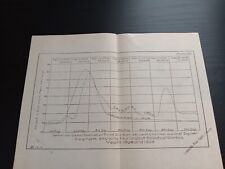
 1909 Rainfall Averages Army Engineering PANAMA CANAL Sketch Diagram Chart
-
$37.00
 1909 Freshets At Gamboa Army Engineering PANAMA CANAL Sketch Diagram Chart
-
$37.00
 1909 Monthly Percipitation Army Engineering PANAMA CANAL Sketch Diagram Chart
-
$39.99
 Vintage Ephemera 1909 Karl Baedeker Traveling Folding Road Map Denver, CO
-
$39.99
 Vintage Ephemera 1909 Karl Baedeker Traveling Folding Road Map Indianapolis, IN
-
$39.99
 Vintage Ephemera 1909 Karl Baedeker Traveling Folding Road Map Newport,RI Harbor
-
$37.00
 1909 Profile locks gates Army Engineering PANAMA CANAL Foldout Sketch Diagram
-
$37.00
 1909 Brazos Brook Station Army Engineering PANAMA CANAL Sketch Diagram Chart
-
$49.99
 1909 Hartford CT Map: Watkinson Juvenile Farm School; Goodwin properties +
-
$37.00
 1909 Illinois Map Murphsboro Quadrangle
-
$39.99
 Vintage Ephemera 1909 Karl Baedeker Traveling Folding Road Map Chicago,Lincoln
-
$39.99
 Vintage 1909 Karl Baedeker Travel Folding Road Map Puerto Rico, Jamaica,Cuba
-
$39.99
 Vintage 1909 Karl Baedeker BOOK & Folding Road Map Minneapolis St Paul Twins MN
-
$39.99
 2. Vintage 1909 Karl Baedeker Traveling Folding Road Map Mexico Valle De Mexico
-
$59.99
 1909 Pocket Map, Shippers Guide & Railroad System to New Jersey
-
$44.00
 Nouvelle Carte Routiere De La Suisse Folding Linen Backed Map 1909 Ex-Library
-
$150.00
 The Delaware Lackawanna & Western Railroad Shippers Map & New York Harbor 1909?
-
$37.00
 1909 South End of Lake Michigan Survey Map Sketch of Triangulation System
-
$225.00
 1909 Highway Map Hampden & Hampshire Counties Mass. - Richards & Sons - Canvas
-
$45.00
 Connecticut and Rhode Island Map. RAND, McNALLY POCKET MAP OF CONNECTICUT. 1909.
-
$25.63
 Bullard 1909 Gazetteer Map Maritime Province North Eastern America Fold Out Book
-
$19.99
 1909 Ward Lock & Co London Illustrated Guide Book with Maps
-
$79.99
 Genuine Antique 1909 Southeast Alaska Khaz Bay Map U.S. Dept of Commerce & Labor
-
$49.99
 1909 Hartford CT Map: Keney Park; Watkinson Farm School; Blue Hills Terrace +
-
$49.99
 1909 Hartford CT Map : Keney Park; Goodwin & Batterson Estates; Cemeteries
-
$37.00
1909 South End of Lake Michigan Survey Map Sketch of Triangulation System